
鱼子西三村 topographic map
Interactive map
Click on the map to display elevation.
About this map
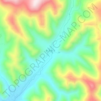
Name: 鱼子西三村 topographic map, elevation, terrain.
Location: 鱼子西三村, 康定市, 甘孜藏族自治州, 四川省, 626000, 中国 (30.14648 101.57888 30.18648 101.61888)
Average elevation: 3,773 m
Minimum elevation: 3,560 m
Maximum elevation: 4,130 m
Other topographic maps
Click on a map to view its topography, its elevation and its terrain.