
Thank you for supporting this site ❤️
Make a donation
Make a donation
Aber-Arad topographic map
Click on the map to display elevation.
Thank you for supporting this site ❤️
Make a donation
Make a donation
About this map
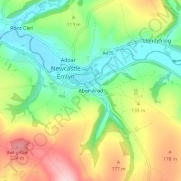
Name: Aber-Arad topographic map, elevation, terrain.
Location: Aber-Arad, Carmarthenshire, Wales, SA38 9DW, United Kingdom (52.01502 -4.47989 52.05502 -4.43989)
Average elevation: 107 m
Minimum elevation: 19 m
Maximum elevation: 245 m
Thank you for supporting this site ❤️
Make a donation
Make a donation
Other topographic maps
Click on a map to view its topography, its elevation and its terrain.