
Thank you for supporting this site ❤️
Make a donation
Make a donation
Ruijas topographic map
Click on the map to display elevation.
Thank you for supporting this site ❤️
Make a donation
Make a donation
About this map
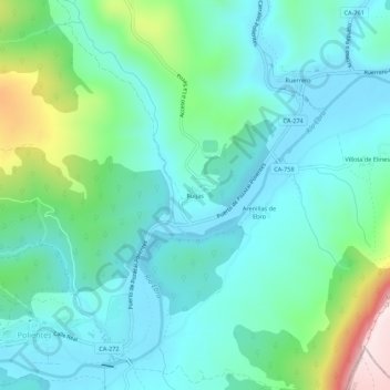
Name: Ruijas topographic map, elevation, terrain.
Location: Ruijas, Valderredible, Cantabria, 39230, España (42.80021 -3.93825 42.84021 -3.89825)
Average elevation: 792 m
Minimum elevation: 687 m
Maximum elevation: 1,170 m
Thank you for supporting this site ❤️
Make a donation
Make a donation
Other topographic maps
Click on a map to view its topography, its elevation and its terrain.