
Thank you for supporting this site ❤️
Make a donation
Make a donation
Lawson topographic map
Click on the map to display elevation.
Thank you for supporting this site ❤️
Make a donation
Make a donation
About this map
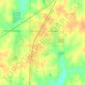
Name: Lawson topographic map, elevation, terrain.
Location: Lawson, Ray County, Missouri, United States (39.42105 -94.23816 39.45007 -94.19303)
Average elevation: 320 m
Minimum elevation: 295 m
Maximum elevation: 335 m
Thank you for supporting this site ❤️
Make a donation
Make a donation