
73491 topographic map
Interactive map
Click on the map to display elevation.
About this map
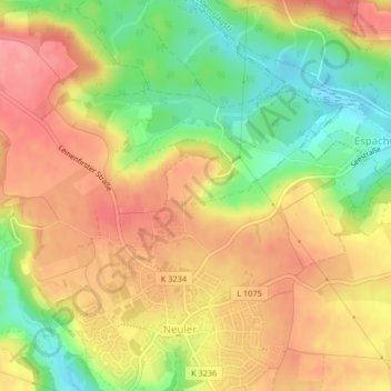
Name: 73491 topographic map, elevation, terrain.
Average elevation: 500 m
Minimum elevation: 449 m
Maximum elevation: 538 m
Other topographic maps
Click on a map to view its topography, its elevation and its terrain.
Ramsenstrut
Deutschland > Baden-Württemberg > Ostalbkreis > Neuler
Ramsenstrut, Neuler, Verwaltungsgemeinschaft Ellwangen (Jagst), Ostalbkreis, Baden-Württemberg, 73491, Deutschland
Average elevation: 484 m