
Thank you for supporting this site ❤️
Make a donation
Make a donation
Reading topographic map
Click on the map to display elevation.
Thank you for supporting this site ❤️
Make a donation
Make a donation
About this map
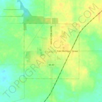
Name: Reading topographic map, elevation, terrain.
Location: Reading, Hillsdale County, Michigan, United States (41.83227 -84.75765 41.84691 -84.73799)
Average elevation: 360 m
Minimum elevation: 345 m
Maximum elevation: 373 m
Thank you for supporting this site ❤️
Make a donation
Make a donation
Other topographic maps
Click on a map to view its topography, its elevation and its terrain.
Thank you for supporting this site ❤️
Make a donation
Make a donation
Thank you for supporting this site ❤️
Make a donation
Make a donation