
永济市 topographic map
Interactive map
Click on the map to display elevation.
About this map
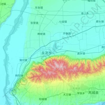
Name: 永济市 topographic map, elevation, terrain.
Location: 永济市, 运城市, 山西省, 中国 (34.67141 110.21954 35.06122 110.76527)
Average elevation: 526 m
Minimum elevation: 318 m
Maximum elevation: 1,951 m
Other topographic maps
Click on a map to view its topography, its elevation and its terrain.