
Thank you for supporting this site ❤️
Make a donation
Make a donation
Rehovot topographic map
Click on the map to display elevation.
Thank you for supporting this site ❤️
Make a donation
Make a donation
About this map
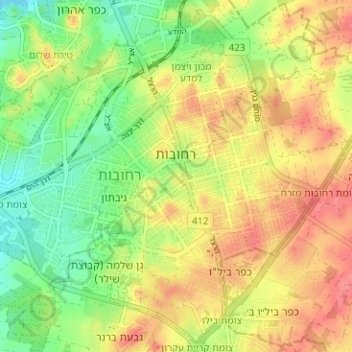
Name: Rehovot topographic map, elevation, terrain.
Location: Rehovot, Rehovot Subdistrict, Center District, Israel (31.86828 34.77053 31.91588 34.83340)
Average elevation: 54 m
Minimum elevation: 20 m
Maximum elevation: 86 m
Thank you for supporting this site ❤️
Make a donation
Make a donation
Other topographic maps
Click on a map to view its topography, its elevation and its terrain.