
Thank you for supporting this site ❤️
Make a donation
Make a donation
Cottesmore topographic map
Click on the map to display elevation.
Thank you for supporting this site ❤️
Make a donation
Make a donation
About this map
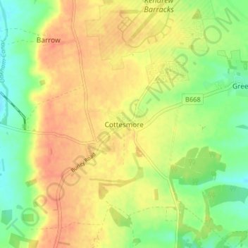
Name: Cottesmore topographic map, elevation, terrain.
Location: Cottesmore, Rutland, England, LE15 7TL, United Kingdom (52.69351 -0.68283 52.73351 -0.64283)
Average elevation: 130 m
Minimum elevation: 105 m
Maximum elevation: 151 m
Thank you for supporting this site ❤️
Make a donation
Make a donation
Other topographic maps
Click on a map to view its topography, its elevation and its terrain.