
Thank you for supporting this site ❤️
Make a donation
Make a donation
Kalangala A topographic map
Click on the map to display elevation.
Thank you for supporting this site ❤️
Make a donation
Make a donation
About this map
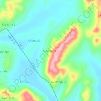
Name: Kalangala A topographic map, elevation, terrain.
Location: Kalangala A, Lwengo, Central Region, Uganda (-0.44254 31.19078 -0.40254 31.23078)
Average elevation: 1,300 m
Minimum elevation: 1,243 m
Maximum elevation: 1,448 m
Thank you for supporting this site ❤️
Make a donation
Make a donation