
Thank you for supporting this site ❤️
Make a donation
Make a donation
Misty Ridge topographic map
Click on the map to display elevation.
Thank you for supporting this site ❤️
Make a donation
Make a donation
About this map
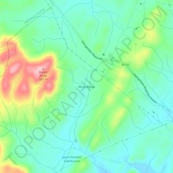
Name: Misty Ridge topographic map, elevation, terrain.
Average elevation: 274 m
Minimum elevation: 226 m
Maximum elevation: 387 m
Thank you for supporting this site ❤️
Make a donation
Make a donation
Other topographic maps
Click on a map to view its topography, its elevation and its terrain.
Hopewell
United States > Tennessee > Bradley County
According to the United States Census Bureau, the CDP has a total area of 7.1 square miles (18 km2), all land. It sits at an elevation of approximately 722 feet (220 m) above sea level, one of the lowest elevations in Bradley County.
Average elevation: 254 m
Thank you for supporting this site ❤️
Make a donation
Make a donation