
渤海镇 topographic map
Interactive map
Click on the map to display elevation.
About this map
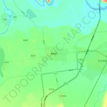
Name: 渤海镇 topographic map, elevation, terrain.
Location: 渤海镇, 宁安市, 牡丹江市, 黑龙江省, 中国 (44.07880 129.12060 44.15880 129.20060)
Average elevation: 285 m
Minimum elevation: 267 m
Maximum elevation: 332 m
Other topographic maps
Click on a map to view its topography, its elevation and its terrain.