
Thank you for supporting this site ❤️
Make a donation
Make a donation
Orovac topographic map
Click on the map to display elevation.
Thank you for supporting this site ❤️
Make a donation
Make a donation
About this map
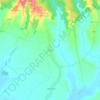
Name: Orovac topographic map, elevation, terrain.
Location: Orovac, Bjelovar-Bilogora County, Croatia (45.84608 16.95598 45.88608 16.99598)
Average elevation: 146 m
Minimum elevation: 120 m
Maximum elevation: 229 m
Thank you for supporting this site ❤️
Make a donation
Make a donation
Other topographic maps
Click on a map to view its topography, its elevation and its terrain.