
Thank you for supporting this site ❤️
Make a donation
Make a donation
Cervantes topographic map
Click on the map to display elevation.
Thank you for supporting this site ❤️
Make a donation
Make a donation
About this map
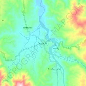
Name: Cervantes topographic map, elevation, terrain.
Location: Cervantes, Ilocos Sur, Ilocos Region, 2718, Philippines (16.94995 120.69546 17.02995 120.77546)
Average elevation: 610 m
Minimum elevation: 394 m
Maximum elevation: 1,214 m
Thank you for supporting this site ❤️
Make a donation
Make a donation