
Thank you for supporting this site ❤️
Make a donation
Make a donation
Cardwell Town topographic map
Click on the map to display elevation.
Thank you for supporting this site ❤️
Make a donation
Make a donation
About this map
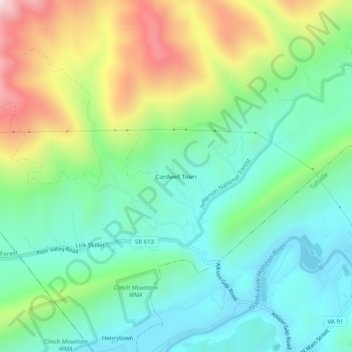
Name: Cardwell Town topographic map, elevation, terrain.
Location: Cardwell Town, Smyth County, Virginia, 24370, United States (36.88206 -81.79901 36.92206 -81.75901)
Average elevation: 736 m
Minimum elevation: 511 m
Maximum elevation: 1,217 m
Thank you for supporting this site ❤️
Make a donation
Make a donation
Other topographic maps
Click on a map to view its topography, its elevation and its terrain.