
Thank you for supporting this site ❤️
Make a donation
Make a donation
Hallerndorf topographic map
Click on the map to display elevation.
Thank you for supporting this site ❤️
Make a donation
Make a donation
About this map
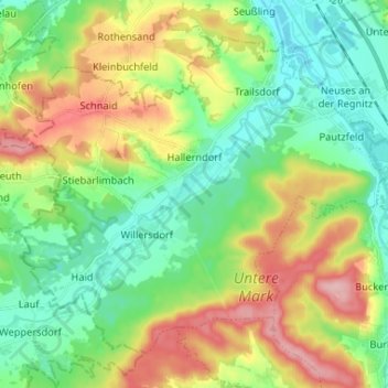
Name: Hallerndorf topographic map, elevation, terrain.
Location: Hallerndorf, Landkreis Forchheim, Bavaria, 91352, Germany (49.71666 10.91301 49.78602 11.04362)
Average elevation: 295 m
Minimum elevation: 245 m
Maximum elevation: 383 m
Thank you for supporting this site ❤️
Make a donation
Make a donation
Other topographic maps
Click on a map to view its topography, its elevation and its terrain.
Thank you for supporting this site ❤️
Make a donation
Make a donation
Ebermannstadt
Germany > Bavaria > Landkreis Forchheim > Ebermannstadt > Ebermannstadt
Average elevation: 408 m