
正斗乡 topographic map
Interactive map
Click on the map to display elevation.
About this map
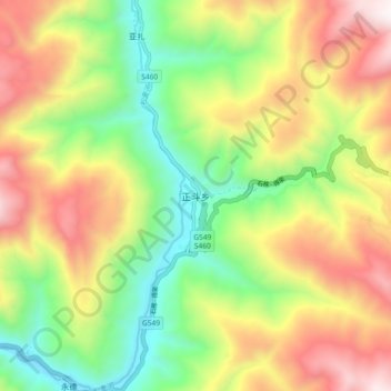
Name: 正斗乡 topographic map, elevation, terrain.
Location: 正斗乡, 乡城县, 甘孜藏族自治州, 四川省, 627800, 中国 (29.09473 99.51075 29.17473 99.59075)
Average elevation: 3,427 m
Minimum elevation: 2,809 m
Maximum elevation: 4,212 m
Other topographic maps
Click on a map to view its topography, its elevation and its terrain.