
Măgurele topographic map
Interactive map
Click on the map to display elevation.
About this map
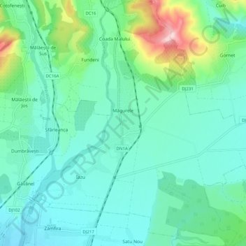
Name: Măgurele topographic map, elevation, terrain.
Location: Măgurele, Prahova, Romania (45.06326 26.00002 45.13398 26.09225)
Average elevation: 277 m
Minimum elevation: 216 m
Maximum elevation: 512 m