
Thank you for supporting this site ❤️
Make a donation
Make a donation
Nedumkunnam topographic map
Click on the map to display elevation.
Thank you for supporting this site ❤️
Make a donation
Make a donation
About this map
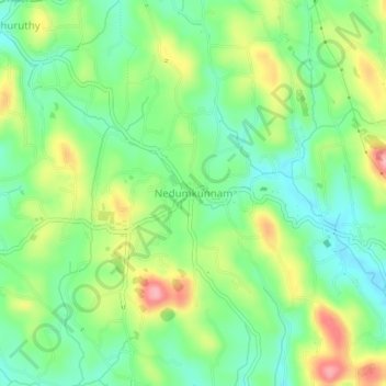
Name: Nedumkunnam topographic map, elevation, terrain.
Location: Nedumkunnam, Changanassery, Kottayam, Kerala, 686542, India (9.48922 76.64466 9.52922 76.68466)
Average elevation: 67 m
Minimum elevation: 20 m
Maximum elevation: 144 m
Thank you for supporting this site ❤️
Make a donation
Make a donation