
Thank you for supporting this site ❤️
Make a donation
Make a donation
Mount Stanford topographic map
Click on the map to display elevation.
Thank you for supporting this site ❤️
Make a donation
Make a donation
About this map
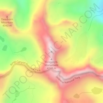
Name: Mount Stanford topographic map, elevation, terrain.
Location: Mount Stanford, Tulare County, California, United States (36.70386 -118.39586 36.70396 -118.39576)
Average elevation: 3,820 m
Minimum elevation: 3,322 m
Maximum elevation: 4,249 m
Thank you for supporting this site ❤️
Make a donation
Make a donation
Other topographic maps
Click on a map to view its topography, its elevation and its terrain.