
Thank you for supporting this site ❤️
Make a donation
Make a donation
La Curva topographic map
Click on the map to display elevation.
Thank you for supporting this site ❤️
Make a donation
Make a donation
About this map
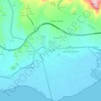
Name: La Curva topographic map, elevation, terrain.
Location: La Curva, Adra, Almería, Andalucía, 04779, España (36.73844 -2.99922 36.77844 -2.95922)
Average elevation: 43 m
Minimum elevation: -1 m
Maximum elevation: 280 m
Thank you for supporting this site ❤️
Make a donation
Make a donation
Other topographic maps
Click on a map to view its topography, its elevation and its terrain.