
Thank you for supporting this site ❤️
Make a donation
Make a donation
Tegallega topographic map
Click on the map to display elevation.
Thank you for supporting this site ❤️
Make a donation
Make a donation
About this map
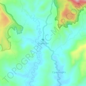
Name: Tegallega topographic map, elevation, terrain.
Location: Tegallega, Sukabumi, West Java, Java, Indonesia (-7.29083 106.81395 -7.25083 106.85395)
Average elevation: 334 m
Minimum elevation: 252 m
Maximum elevation: 591 m
Thank you for supporting this site ❤️
Make a donation
Make a donation