
Thank you for supporting this site ❤️
Make a donation
Make a donation
Bethany topographic map
Click on the map to display elevation.
Thank you for supporting this site ❤️
Make a donation
Make a donation
About this map
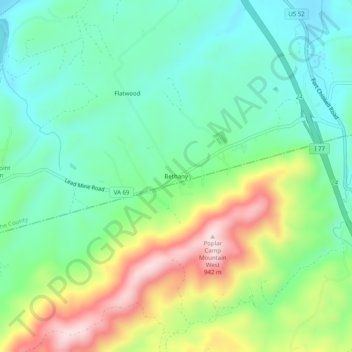
Name: Bethany topographic map, elevation, terrain.
Location: Bethany, Wythe County, Virginia, 24312, United States (36.82373 -80.90036 36.86373 -80.86036)
Average elevation: 702 m
Minimum elevation: 590 m
Maximum elevation: 925 m
Thank you for supporting this site ❤️
Make a donation
Make a donation
Other topographic maps
Click on a map to view its topography, its elevation and its terrain.