
Thank you for supporting this site ❤️
Make a donation
Make a donation
Ugglarp topographic map
Click on the map to display elevation.
Thank you for supporting this site ❤️
Make a donation
Make a donation
About this map
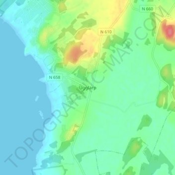
Name: Ugglarp topographic map, elevation, terrain.
Location: Ugglarp, Falkenbergs kommun, Halland County, 311 69, Sweden (56.79778 12.60681 56.83778 12.64681)
Average elevation: 17 m
Minimum elevation: -1 m
Maximum elevation: 69 m
Thank you for supporting this site ❤️
Make a donation
Make a donation
Other topographic maps
Click on a map to view its topography, its elevation and its terrain.
Thank you for supporting this site ❤️
Make a donation
Make a donation
Thank you for supporting this site ❤️
Make a donation
Make a donation