
Thank you for supporting this site ❤️
Make a donation
Make a donation
Munson Knob topographic map
Click on the map to display elevation.
Thank you for supporting this site ❤️
Make a donation
Make a donation
About this map
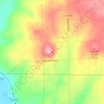
Name: Munson Knob topographic map, elevation, terrain.
Location: Munson Knob, Wayne County, Ohio, United States (40.67306 -81.92964 40.67316 -81.92954)
Average elevation: 326 m
Minimum elevation: 250 m
Maximum elevation: 387 m
Thank you for supporting this site ❤️
Make a donation
Make a donation
Other topographic maps
Click on a map to view its topography, its elevation and its terrain.
Thank you for supporting this site ❤️
Make a donation
Make a donation
Thank you for supporting this site ❤️
Make a donation
Make a donation
Doylestown
United States > Ohio > Wayne County
A handful of small streams begin at springs on the slopes of the hill and flow from the higher elevations into larger creeks surrounding the village. Silver Creek drains the town on the east, Mill Creek on the north and west, while Chippewa Creek drains the south side and collects both Mill and Silver Creeks.…
Average elevation: 353 m