
Thank you for supporting this site ❤️
Make a donation
Make a donation
Malunda topographic map
Click on the map to display elevation.
Thank you for supporting this site ❤️
Make a donation
Make a donation
About this map
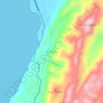
Name: Malunda topographic map, elevation, terrain.
Location: Malunda, Majene, West Sulawesi, Sulawesi, Indonesia (-3.05452 118.84449 -3.01452 118.88449)
Average elevation: 177 m
Minimum elevation: 0 m
Maximum elevation: 527 m
Thank you for supporting this site ❤️
Make a donation
Make a donation