
Thank you for supporting this site ❤️
Make a donation
Make a donation
Transou topographic map
Click on the map to display elevation.
Thank you for supporting this site ❤️
Make a donation
Make a donation
About this map
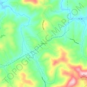
Name: Transou topographic map, elevation, terrain.
Location: Transou, Ashe County, North Carolina, 28644, United States (36.38402 -81.32037 36.42402 -81.28037)
Average elevation: 906 m
Minimum elevation: 821 m
Maximum elevation: 1,067 m
Thank you for supporting this site ❤️
Make a donation
Make a donation
Other topographic maps
Click on a map to view its topography, its elevation and its terrain.