
Thank you for supporting this site ❤️
Make a donation
Make a donation
Aspelare topographic map
Click on the map to display elevation.
Thank you for supporting this site ❤️
Make a donation
Make a donation
About this map
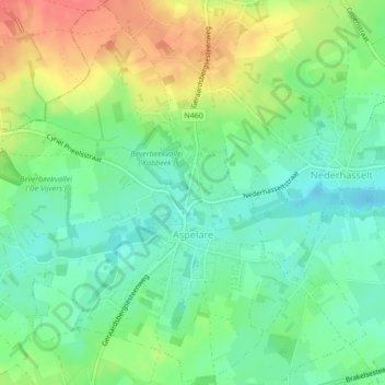
Name: Aspelare topographic map, elevation, terrain.
Location: Aspelare, Ninove, Aalst, East Flanders, Flanders, 9404, Belgium (50.83173 3.92567 50.85844 3.96866)
Average elevation: 39 m
Minimum elevation: 15 m
Maximum elevation: 76 m
Thank you for supporting this site ❤️
Make a donation
Make a donation
Other topographic maps
Click on a map to view its topography, its elevation and its terrain.