
Woodford topographic map
Interactive map
Click on the map to display elevation.
About this map
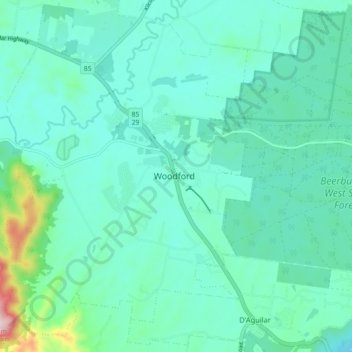
Name: Woodford topographic map, elevation, terrain.
Location: Woodford, Queensland, 4514, Australia (-26.99481 152.73831 -26.91481 152.81831)
Average elevation: 142 m
Minimum elevation: 75 m
Maximum elevation: 484 m
Other topographic maps
Click on a map to view its topography, its elevation and its terrain.
Woodford
Australia > Queensland > Woodford
Woodford, Greater Brisbane, Moreton Bay Regional, Queensland, 4514, Australia
Average elevation: 148 m