
Thank you for supporting this site ❤️
Make a donation
Make a donation
Diamond Head topographic map
Click on the map to display elevation.
Thank you for supporting this site ❤️
Make a donation
Make a donation
About this map
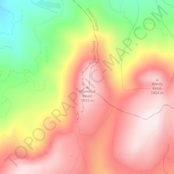
Name: Diamond Head topographic map, elevation, terrain.
Location: Diamond Head, Kittitas County, Washington, United States (47.31145 -120.57108 47.31155 -120.57098)
Average elevation: 1,571 m
Minimum elevation: 1,217 m
Maximum elevation: 1,818 m
Thank you for supporting this site ❤️
Make a donation
Make a donation
Other topographic maps
Click on a map to view its topography, its elevation and its terrain.