
Thank you for supporting this site ❤️
Make a donation
Make a donation
Meni topographic map
Click on the map to display elevation.
Thank you for supporting this site ❤️
Make a donation
Make a donation
About this map
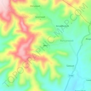
Name: Meni topographic map, elevation, terrain.
Location: Meni, Ranjanwadi, Shirala, Sangli District, Maharashtra, India (17.07117 73.97903 17.11117 74.01903)
Average elevation: 718 m
Minimum elevation: 591 m
Maximum elevation: 907 m
Thank you for supporting this site ❤️
Make a donation
Make a donation