
Thank you for supporting this site ❤️
Make a donation
Make a donation
Paindorf topographic map
Click on the map to display elevation.
Thank you for supporting this site ❤️
Make a donation
Make a donation
About this map
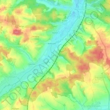
Name: Paindorf topographic map, elevation, terrain.
Average elevation: 478 m
Minimum elevation: 441 m
Maximum elevation: 522 m
Thank you for supporting this site ❤️
Make a donation
Make a donation
Other topographic maps
Click on a map to view its topography, its elevation and its terrain.
85283
Germany > Bavaria > Landkreis Pfaffenhofen an der Ilm > Wolnzach > Jebertshausen
Average elevation: 451 m
Thank you for supporting this site ❤️
Make a donation
Make a donation