
Thank you for supporting this site ❤️
Make a donation
Make a donation
Tumshuq topographic map
Click on the map to display elevation.
Thank you for supporting this site ❤️
Make a donation
Make a donation
About this map
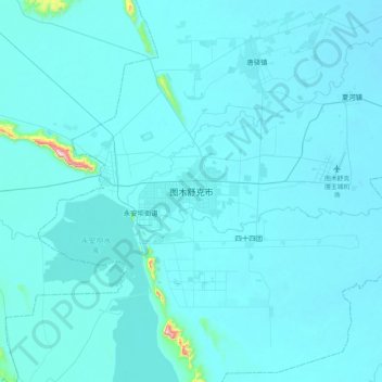
Name: Tumshuq topographic map, elevation, terrain.
Location: Tumshuq, Boundary Maralbeshi - Kashgar, Xinjiang, China (39.70649 78.91240 40.02649 79.23240)
Average elevation: 1,104 m
Minimum elevation: 1,085 m
Maximum elevation: 1,670 m
Thank you for supporting this site ❤️
Make a donation
Make a donation