
Thank you for supporting this site ❤️
Make a donation
Make a donation
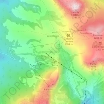
Rolle Pass topographic map
Click on the map to display elevation.
Thank you for supporting this site ❤️
Make a donation
Make a donation
Rolle Pass
Due to altitude, the climate is subarctic (Köppen: Dfc), similar to other high mountains in the Alps. The annual average temperature is 3.2 °C (37.8 °F), the hottest month in July is 11.8 °C (53.2 °F), and the coldest month is −4.4 °C (24.1 °F) in February. The annual precipitation is 1,004.11 millimetres (39.53 in), of which October is the wettest with 142.23 millimetres (5.60 in), while February is the driest with only 29.05 millimetres (1.14 in).
Thank you for supporting this site ❤️
Make a donation
Make a donation
About this map
Name: Rolle Pass topographic map, elevation, terrain.
Average elevation: 1,996 m
Minimum elevation: 1,772 m
Maximum elevation: 2,307 m
Thank you for supporting this site ❤️
Make a donation
Make a donation