
Thank you for supporting this site ❤️
Make a donation
Make a donation
Gunnison topographic map
Click on the map to display elevation.
Thank you for supporting this site ❤️
Make a donation
Make a donation
About this map
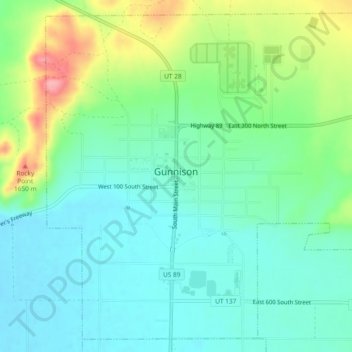
Name: Gunnison topographic map, elevation, terrain.
Location: Gunnison, Sanpete County, Utah, 84634, United States (39.13796 -111.83557 39.17157 -111.78891)
Average elevation: 1,579 m
Minimum elevation: 1,545 m
Maximum elevation: 1,660 m
Thank you for supporting this site ❤️
Make a donation
Make a donation
Other topographic maps
Click on a map to view its topography, its elevation and its terrain.