
Make a donation
Fort Canning Park topographic map
Click on the map to display elevation.
Make a donation
Fort Canning Park
The hill has a long history intertwined with that of the country due to its location as the highest elevation within walking distance to the city's civic district, within the Downtown Core. It is also a popular location for exhibitions, concerts, and outdoor recreation.
Make a donation
About this map
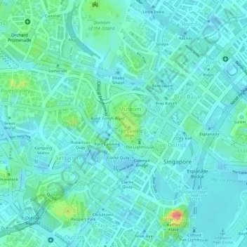
Name: Fort Canning Park topographic map, elevation, terrain.
Location: Fort Canning Park, Central Region, Singapore (1.29058 103.84386 1.29750 103.84957)
Average elevation: 19 m
Minimum elevation: 0 m
Maximum elevation: 97 m
Make a donation
Other topographic maps
Click on a map to view its topography, its elevation and its terrain.
Make a donation
Make a donation
Make a donation
Make a donation
Make a donation
Make a donation
Make a donation
Yunnan
Yunnan is situated in a mountainous area, with high elevations in the Northwest and low elevations in the Southeast. Most of the population lives in the eastern part of the province. In the west, the altitude can vary from the mountain peaks to river valleys as much as 3,000 m (9,800 ft). Yunnan is rich in…
Average elevation: 20 m
Make a donation
Make a donation
Make a donation
Make a donation
Make a donation
Make a donation
Make a donation
Make a donation
Make a donation
Make a donation
Make a donation
Make a donation
Bukit Panjang
Bukit Panjang (/ˈbʊkɪt ˌpɑːndʒɑːŋ/ BUUK-it PAHN-jahng) is a planning area and residential town located in the West Region of Singapore. A portion of this town is situated on a low-lying elongated hill. The planning area is bounded by Bukit Batok to the west, Choa Chu Kang to the northwest, Sungei…
Average elevation: 44 m
Make a donation
Make a donation
Make a donation