
Thank you for supporting this site ❤️
Make a donation
Make a donation
Boston topographic map
Click on the map to display elevation.
Thank you for supporting this site ❤️
Make a donation
Make a donation
About this map
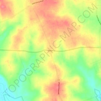
Name: Boston topographic map, elevation, terrain.
Location: Boston, Highland County, Ohio, United States (39.19534 -83.53103 39.23534 -83.49103)
Average elevation: 306 m
Minimum elevation: 266 m
Maximum elevation: 336 m
Thank you for supporting this site ❤️
Make a donation
Make a donation
Other topographic maps
Click on a map to view its topography, its elevation and its terrain.