
Loriol-sur-Drôme topographic map
Interactive map
Click on the map to display elevation.
About this map
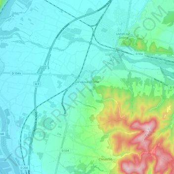
Name: Loriol-sur-Drôme topographic map, elevation, terrain.
Average elevation: 158 m
Minimum elevation: 78 m
Maximum elevation: 472 m
Other topographic maps
Click on a map to view its topography, its elevation and its terrain.
Drôme
France > Auvergne-Rhône-Alpes > Drôme
Drôme, Auvergne-Rhône-Alpes, Metropolitan France, France
Average elevation: 683 m