
Thank you for supporting this site ❤️
Make a donation
Make a donation
Tahivilla topographic map
Click on the map to display elevation.
Thank you for supporting this site ❤️
Make a donation
Make a donation
About this map
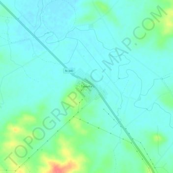
Name: Tahivilla topographic map, elevation, terrain.
Average elevation: 19 m
Minimum elevation: 5 m
Maximum elevation: 67 m
Thank you for supporting this site ❤️
Make a donation
Make a donation
Other topographic maps
Click on a map to view its topography, its elevation and its terrain.
Sierra de la Plata
España > Andalucía > Campo de Gibraltar > Tarifa > Atlanterra
Average elevation: 162 m
Thank you for supporting this site ❤️
Make a donation
Make a donation
Playa de Bolonia
España > Andalucía > Campo de Gibraltar > Tarifa > El Lentiscal
Average elevation: 19 m
Playa de En Medio o de los Alemanes
España > Andalucía > Campo de Gibraltar > Tarifa > Atlanterra
Average elevation: 53 m