
Thank you for supporting this site ❤️
Make a donation
Make a donation
Kotamobagu topographic map
Click on the map to display elevation.
Thank you for supporting this site ❤️
Make a donation
Make a donation
About this map
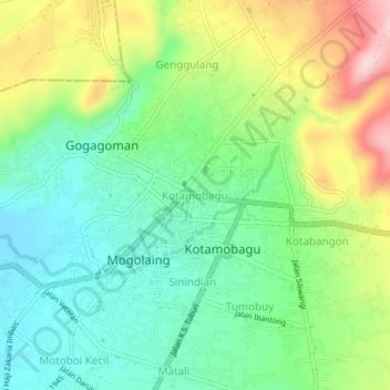
Name: Kotamobagu topographic map, elevation, terrain.
Location: Kotamobagu, North Sulawesi, Sulawesi, 95711, Indonesia (0.72071 124.29254 0.76071 124.33254)
Average elevation: 271 m
Minimum elevation: 186 m
Maximum elevation: 422 m
Thank you for supporting this site ❤️
Make a donation
Make a donation