
藤县 topographic map
Interactive map
Click on the map to display elevation.
About this map
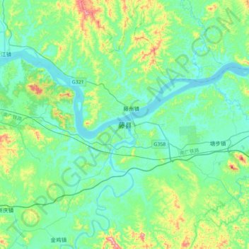
Name: 藤县 topographic map, elevation, terrain.
Location: 藤县, 梧州市, 广西壮族自治区, 543000, 中国 (23.21805 110.75031 23.53805 111.07031)
Average elevation: 92 m
Minimum elevation: 6 m
Maximum elevation: 439 m
Other topographic maps
Click on a map to view its topography, its elevation and its terrain.