
Thank you for supporting this site ❤️
Make a donation
Make a donation
Lake Monroe topographic map
Click on the map to display elevation.
Thank you for supporting this site ❤️
Make a donation
Make a donation
About this map
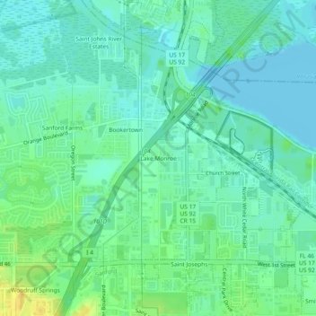
Name: Lake Monroe topographic map, elevation, terrain.
Location: Lake Monroe, Seminole County, Florida, 32747, United States (28.80471 -81.34701 28.84471 -81.30701)
Average elevation: 8 m
Minimum elevation: -3 m
Maximum elevation: 26 m
Thank you for supporting this site ❤️
Make a donation
Make a donation
Other topographic maps
Click on a map to view its topography, its elevation and its terrain.