
Thank you for supporting this site ❤️
Make a donation
Make a donation
Oval topographic map
Click on the map to display elevation.
Thank you for supporting this site ❤️
Make a donation
Make a donation
About this map
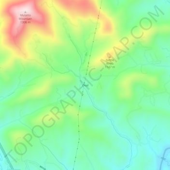
Name: Oval topographic map, elevation, terrain.
Location: Oval, Ashe County, North Carolina, 28626, United States (36.31040 -81.50816 36.35040 -81.46816)
Average elevation: 1,011 m
Minimum elevation: 858 m
Maximum elevation: 1,306 m
Thank you for supporting this site ❤️
Make a donation
Make a donation
Other topographic maps
Click on a map to view its topography, its elevation and its terrain.