
Thank you for supporting this site ❤️
Make a donation
Make a donation
Rumonge topographic map
Click on the map to display elevation.
Thank you for supporting this site ❤️
Make a donation
Make a donation
About this map
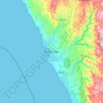
Name: Rumonge topographic map, elevation, terrain.
Location: Rumonge, Burundi (-4.13455 29.27929 -3.81455 29.59929)
Average elevation: 1,013 m
Minimum elevation: 767 m
Maximum elevation: 2,125 m
Thank you for supporting this site ❤️
Make a donation
Make a donation