
Thank you for supporting this site ❤️
Make a donation
Make a donation
Bengal topographic map
Click on the map to display elevation.
Thank you for supporting this site ❤️
Make a donation
Make a donation
About this map
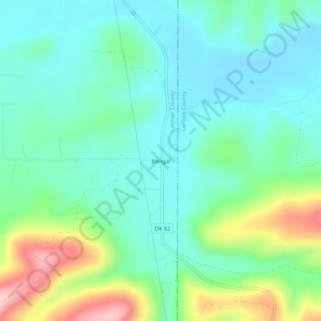
Name: Bengal topographic map, elevation, terrain.
Location: Bengal, Latimer County, Oklahoma, United States (34.81277 -95.08205 34.85277 -95.04205)
Average elevation: 241 m
Minimum elevation: 183 m
Maximum elevation: 399 m
Thank you for supporting this site ❤️
Make a donation
Make a donation
Other topographic maps
Click on a map to view its topography, its elevation and its terrain.