
Thank you for supporting this site ❤️
Make a donation
Make a donation
Sitheri topographic map
Click on the map to display elevation.
Thank you for supporting this site ❤️
Make a donation
Make a donation
About this map
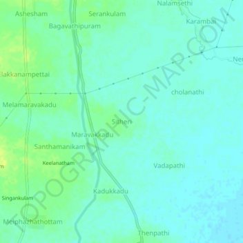
Name: Sitheri topographic map, elevation, terrain.
Location: Sitheri, Mannargudi, Thiruvarur, Tamil Nadu, 614001, India (10.60912 79.45174 10.64912 79.49174)
Average elevation: 14 m
Minimum elevation: 8 m
Maximum elevation: 24 m
Thank you for supporting this site ❤️
Make a donation
Make a donation