
Thank you for supporting this site ❤️
Make a donation
Make a donation
The Flatirons topographic map
Click on the map to display elevation.
Thank you for supporting this site ❤️
Make a donation
Make a donation
About this map
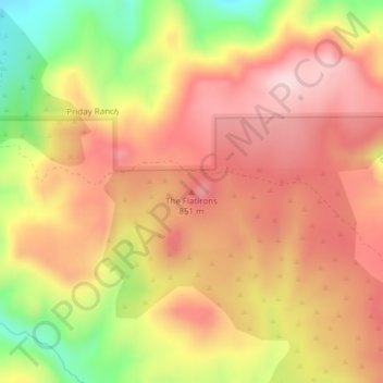
Name: The Flatirons topographic map, elevation, terrain.
Location: The Flatirons, Jefferson County, Oregon, United States (44.80674 -120.87620 44.80684 -120.87610)
Average elevation: 782 m
Minimum elevation: 580 m
Maximum elevation: 913 m
Thank you for supporting this site ❤️
Make a donation
Make a donation
Other topographic maps
Click on a map to view its topography, its elevation and its terrain.