

North Yorkshire topographic map
Click on the map to display elevation.
About this map

Name: North Yorkshire topographic map, elevation, terrain.
Location: North Yorkshire, England, United Kingdom (53.62109 -2.56474 54.56214 -0.21235)
Average elevation: 153 m
Minimum elevation: -1 m
Maximum elevation: 880 m
Other topographic maps
Click on a map to view its topography, its elevation and its terrain.
Plymouth
United Kingdom > England > Devon > Plymouth
The River Plym, which flows off Dartmoor to the north-east, forms a smaller estuary to the east of the city called Cattewater. Plymouth Sound is protected from the sea by the Plymouth Breakwater, in use since 1814. In the Sound is Drake's Island which is seen from Plymouth Hoe, a flat public area on top of…
Average elevation: 81 m
Portsmouth
United Kingdom > England > Hampshire > Portsmouth
By road, Portsmouth lies 73.5 miles (118.3 km) from Central London, 49.5 miles (79.7 km) west of Brighton, and 22.3 miles (35.9 km) east of Southampton. Portsmouth is situated primarily on Portsea Island and is the United Kingdom's only island city, although parts of it have expanded onto the mainland. Gosport…
Average elevation: 28 m

Cambridge
United Kingdom > England > Cambridge
The city, like most of the UK, has a maritime climate highly influenced by the Gulf Stream. Located in the driest region of Britain, Cambridge's rainfall averages around 570 mm (22.44 in) per year, around half the national average, with some years occasionally falling into the semi-arid (under 500 mm (19.69…
Average elevation: 18 m

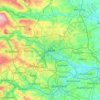
Leeds
Lying in the eastern foothills of the Pennines, there is a significant variation in elevation within the city's built-up area. The district ranges from 1,115 feet (340 m) in the far west on the slopes of Ilkley Moor to about 33 feet (10 m) where the rivers Aire and Wharfe cross the eastern boundary. Land rises…
Average elevation: 94 m


Merevale Lake
United Kingdom > England > Warwickshire > North Warwickshire > Atherstone
Average elevation: 119 m


Sydenham
United Kingdom > England > Greater London
In the area where West Hill (later renamed Westwood Hill) and Crystal Palace Park Road raise in elevation and eventually meet, many fine villas were built in the latter half of the nineteenth century. Designed in revival architectural styles, fashionable at the time, most of the properties were three or four…
Average elevation: 45 m



Exeter
United Kingdom > England > Devon > Exeter
The city of Exeter was established on the eastern bank of the River Exe on a ridge of land backed by a steep hill. It is at this point that the Exe, having just been joined by the River Creedy, opens onto a wide flood plain and estuary which results in quite common flooding. Historically this was the lowest…
Average elevation: 99 m




Reading
United Kingdom > England > Reading
Mary Russell Mitford lived in Reading for a number of years and then spent the rest of her life just outside the town at Three Mile Cross and Swallowfield. The fictional Belford Regis of her eponymous novel, first published in 1835, is largely based on Reading. Described with topographical accuracy, it is…
Average elevation: 56 m
Peterborough
United Kingdom > England > Cambridgeshire
The local topography is flat, and in some places, the land lies below sea level, for example in parts of the Fens to the east and to the south of Peterborough. Human settlement in the area began before the Bronze Age, as can be seen at the Flag Fen archaeological site to the east of the current city centre,…
Average elevation: 17 m





Botley Hill
United Kingdom > England > Surrey > Tandridge
Botley Hill is a Marilyn (a hill with topographic prominence of at least 150m), and the third highest point in the county (after the peaks of Leith Hill south of Dorking and Gibbet Hill in Hindhead, both on the Greensand Ridge).
Average elevation: 206 m
Ravenstone
United Kingdom > England > Leicestershire > North West Leicestershire
Average elevation: 143 m


Bradford
Bradford is located at 53°45′00″N 01°50′00″W / 53.75000°N 1.83333°W / 53.75000; -1.83333 (53.7500, -1.8333)1. Topographically, it is located in the eastern moorland region of the South Pennines.
Average elevation: 167 m

Helpringham
United Kingdom > England > Lincolnshire > North Kesteven > Helpringham
Average elevation: 8 m

Harrow
United Kingdom > England > London Borough of Harrow > Harrow
The town centre is about 220 feet (67 m) above sea level, almost 200 feet (61 m) below the top of Harrow Hill, which is an outlying knoll. The hill is half a mile south of the town centre, and the settlement is rich with historic architecture and has a village atmosphere. The steep climb towards the hill is…
Average elevation: 57 m


Hengistbury Head
United Kingdom > England > Bournemouth, Christchurch and Poole > Bournemouth
In 1910 the first international aviation meeting ever held in Britain took place on a specially laid out aerodrome consisting of a mile of grassland between the "Double Dykes" and the nearby village of Tuckton. About twenty pioneer aviators from around the world participated in various competitions including…
Average elevation: 0 m
Littleborough
United Kingdom > England > Rochdale
In the late 18th century, the low-altitude Summit Gap between Littleborough and Walsden was approved as the best route over the Pennines for the Rochdale Canal and the Manchester to Leeds railway; Hollingworth Lake was built at Littleborough's south side as a feeder reservoir to regulate the waters of the…
Average elevation: 266 m






Bishop's Stortford
United Kingdom > England > East Hertfordshire > Bishop's Stortford
Average elevation: 85 m




Burton upon Trent
United Kingdom > England > Staffordshire > East Staffordshire
Burton is about 109 miles (175 km) north west of London, about 30 miles north east of Birmingham, the UK's second largest city and about 23 miles east of the county town Stafford. It is at the easternmost border of the county of Staffordshire with Derbyshire, its suburbs and the course of the River Trent…
Average elevation: 69 m
Bollitree Castle
United Kingdom > England > Herefordshire > Weston under Penyard
Average elevation: 87 m

