
Thank you for supporting this site ❤️
Make a donation
Make a donation
Cotswold District topographic map
Click on the map to display elevation.
Thank you for supporting this site ❤️
Make a donation
Make a donation
About this map
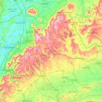
Name: Cotswold District topographic map, elevation, terrain.
Location: Cotswold District, Gloucestershire, England, United Kingdom (51.57753 -2.32361 52.11258 -1.61520)
Average elevation: 118 m
Minimum elevation: 6 m
Maximum elevation: 328 m
Thank you for supporting this site ❤️
Make a donation
Make a donation