
Thank you for supporting this site ❤️
Make a donation
Make a donation
Monticello topographic map
Click on the map to display elevation.
Thank you for supporting this site ❤️
Make a donation
Make a donation
About this map
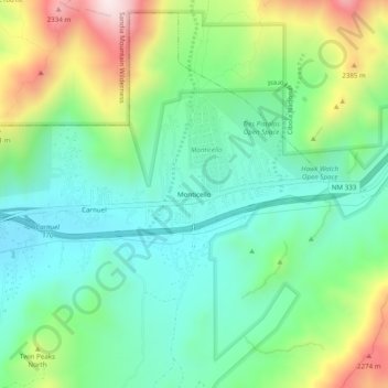
Name: Monticello topographic map, elevation, terrain.
Location: Monticello, Bernalillo County, New Mexico, United States (35.04530 -106.46464 35.08530 -106.42464)
Average elevation: 1,949 m
Minimum elevation: 1,747 m
Maximum elevation: 2,388 m
Thank you for supporting this site ❤️
Make a donation
Make a donation
Other topographic maps
Click on a map to view its topography, its elevation and its terrain.
Joe M. Lucero Hillside
United States > New Mexico > Bernalillo County > Albuquerque
Average elevation: 1,637 m